Luang Prabang in the Shadow of a Dam
A sacred river landscape between memory, development, and displacement
At the mouth of the Nam Ou, where the river meets the Mekong, the landscape around Pak Ou has long been shaped by water, faith, trade, and village life. Boats carry pilgrims to the caves. Fishermen read the current. Families grow food along the riverbank. Temples stand not only as places of worship, but as anchors of memory, ceremony, and community.
This is the wider river world connected to Luang Prabang - a UNESCO World Heritage city whose identity has never belonged only to its temples, old streets, and colonial architecture, but also to the mountains, rivers, villages, and spiritual geography that surround it.
Today, that landscape is being redrawn.
Roads, bridges, construction traffic, concrete structures, and hydropower infrastructure now appear beside places once defined by forested slopes, river gardens, boat landings, and village temples. The Luang Prabang hydropower project on the Mekong has become the most visible symbol of this change. But these photographs also look beyond one dam. They trace a longer story of what hydropower development has already done along the Nam Ou, one of the Mekong’s most important tributaries.
In villages affected by the Nam Ou dams, the consequences are no longer abstract. A temple once built on dry ground now stands partly submerged in reservoir water. A relocated temple has been rebuilt, but villagers must donate their own money to restore the murals, stories, and spiritual details that made the old temple feel alive. Houses provided as compensation may shelter families, but they cannot easily replace gardens, fruit trees, fishing grounds, open space, or the everyday self-sufficiency that once surrounded village life.
“The dam did not only move buildings.”
“It changed the relationship between people, river, food, worship, and memory.”
For fishermen near Pak Nam Ou, the river has also become harder to read. The natural rhythm of water levels, currents, fish movement, and boat travel is increasingly uncertain. When the river changes, local knowledge built over generations becomes less reliable. A day without fish is no longer only a poor catch. It can mean no food for the family, no money for fuel, and another step toward debt.
For shopkeepers, boat operators, and families around Pak Ou Caves, the concern is also practical. Tourism here depends on the river remaining navigable, beautiful, and culturally meaningful. If currents become more dangerous, if boat travel becomes harder, or if the landscape loses the qualities that brought visitors in the first place, then one of the few steady income sources tied directly to the river may weaken.
The question facing Luang Prabang is therefore not only whether a dam can produce electricity.
It is whether development can measure what exists before the concrete arrives: a temple wall painted by village donations, a fisherman’s evening catch, a woman tending vegetables beside the river, a souvenir seller praying inside a cave, a family trying to make a compensation house feel like home.
In the shadow of hydropower, the cost of development is not always dramatic. Sometimes it appears quietly - in a lost garden, a difficult climb to a relocated temple, a changed current, a silent reservoir, or a river that no longer behaves as people remember.
“This story asks what happens when a river landscape is treated as infrastructure - and whether Luang Prabang can remain itself if the living river around it is transformed.”
This body of work was photographed on assignment for Neue Zürcher Zeitung (NZZ), as part of a wider visual report on hydropower development, river communities, and the changing landscape around Luang Prabang and the Mekong.
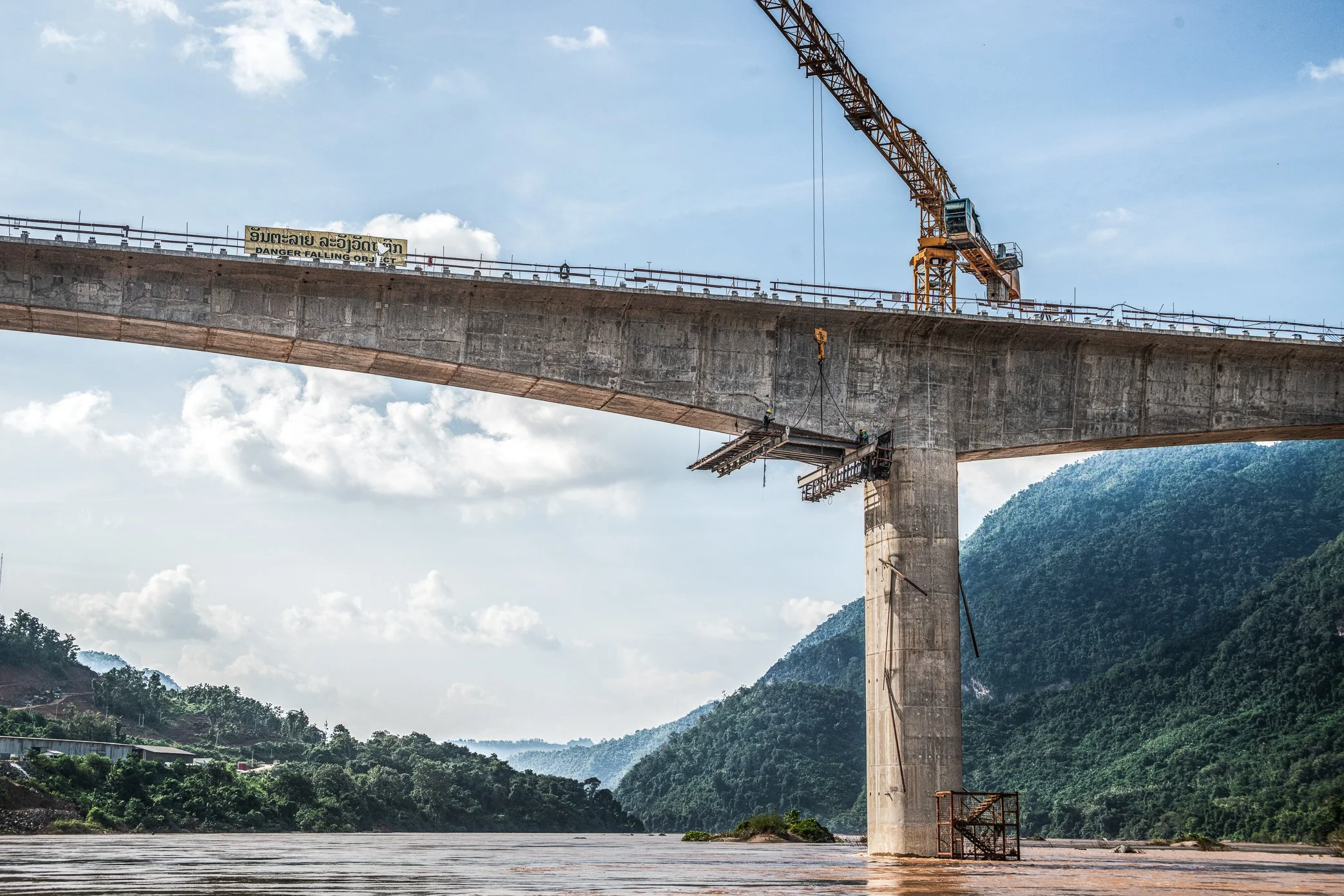
A new bridge rises over the Mekong near the mouth of the Nam Ou, where two rivers meet outside Luang Prabang. Built through a landscape of forested mountains and river villages, the bridge forms part of the expanding infrastructure around the Luang Prabang hydropower project. One of its key roles is to move construction materials and heavy machinery toward the dam site nearby - a project reshaping not only the river’s flow, but also the cultural and ecological landscape around this World Heritage city.
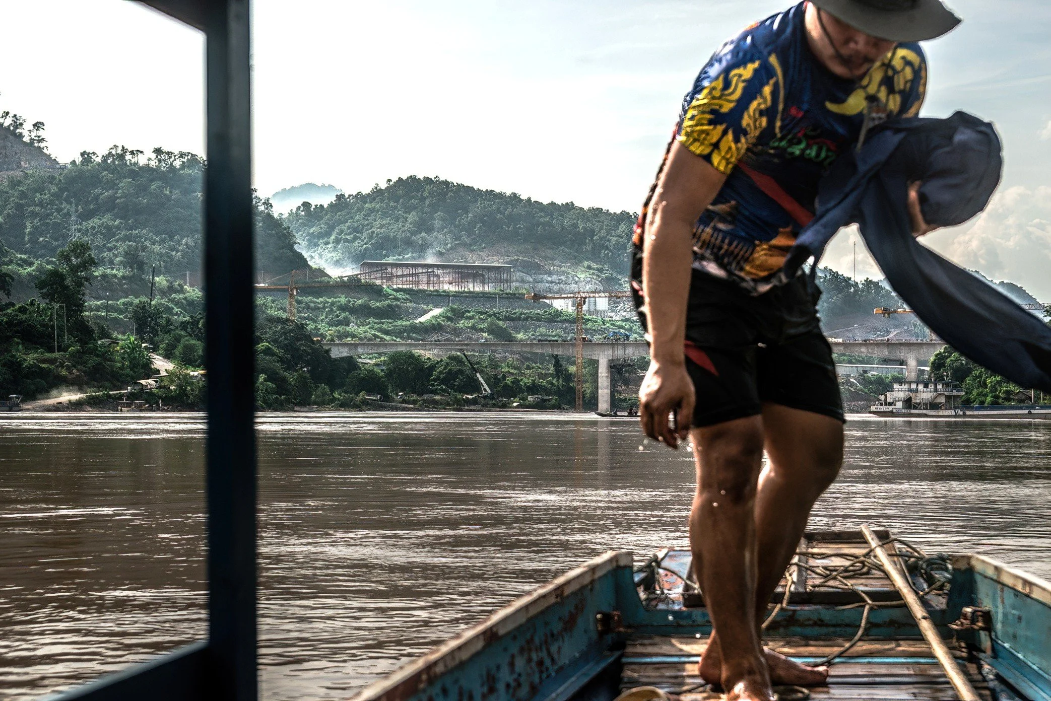
From a local tour boat on the Mekong, the changing landscape near the mouth of the Nam Ou comes into view. For villagers, boatmen, fishermen, and small tourism businesses, this stretch of river has long been part of daily life and local income. Now, the view is shifting from forested mountains and open riverbanks to roads, cranes, bridges, and concrete structures linked to the Luang Prabang hydropower project. “The river is still carrying people,” but it is also carrying the visible weight of development.
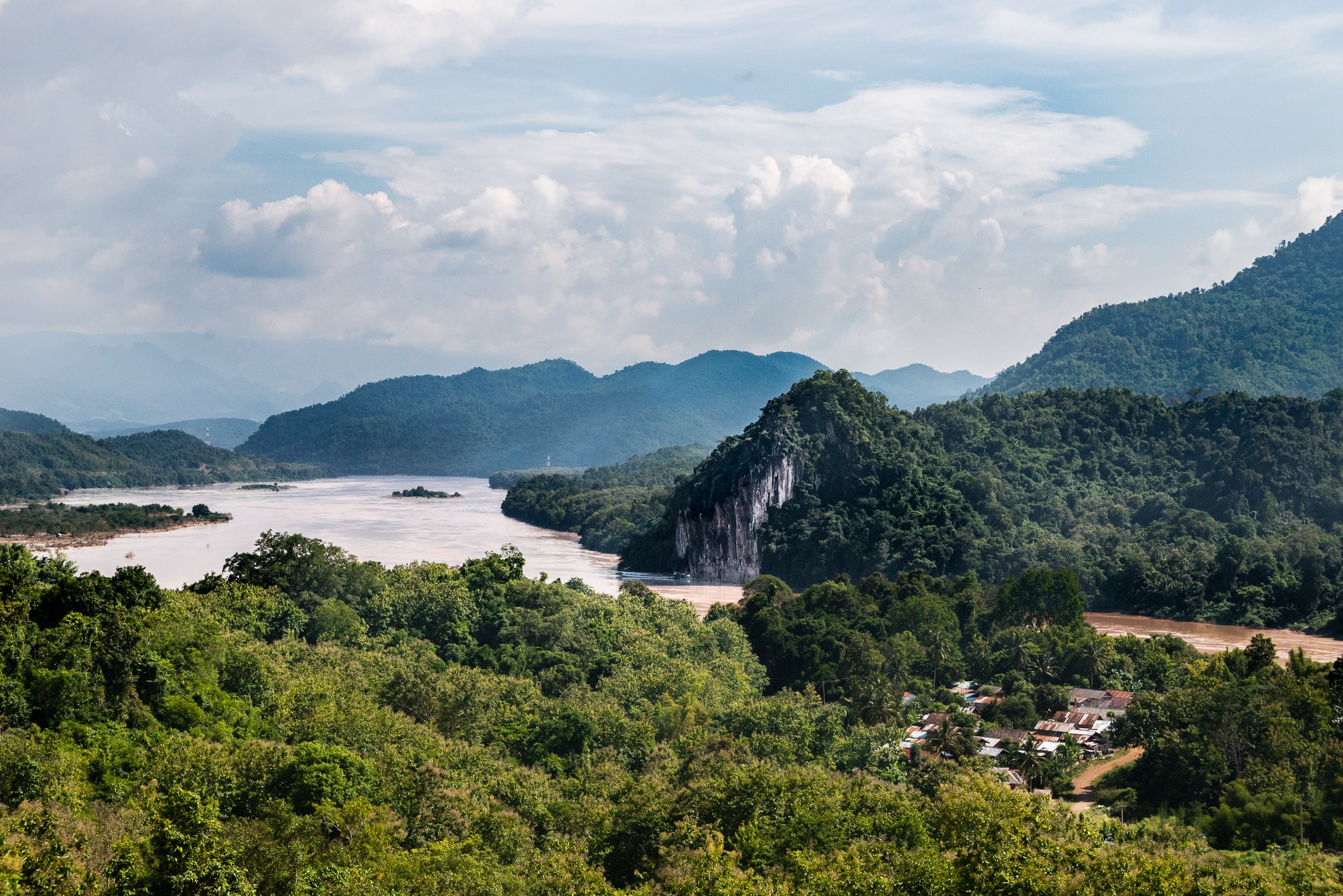
The landscape around Pak Ou, where the Nam Ou meets the Mekong River, remains one of the most important cultural and ecological places near Luang Prabang. Small villages in this area depend on fishing, boat transport, temple tourism, and the daily movement of people along the river. But many villagers worry that the new Luang Prabang hydropower project, being built upstream on the Mekong, will bring another layer of change to a river system already altered by dams. Technical reviews and outside reporting have raised concerns about hydrology, sediment, fish migration, boating, and cumulative downstream impacts. For local fishermen and boat operators, sudden changes in current and water level could make the river harder to read - and more dangerous to work. “The beauty of Pak Ou is not separate from the river’s movement.” If the river changes, the lives built around it change as well.
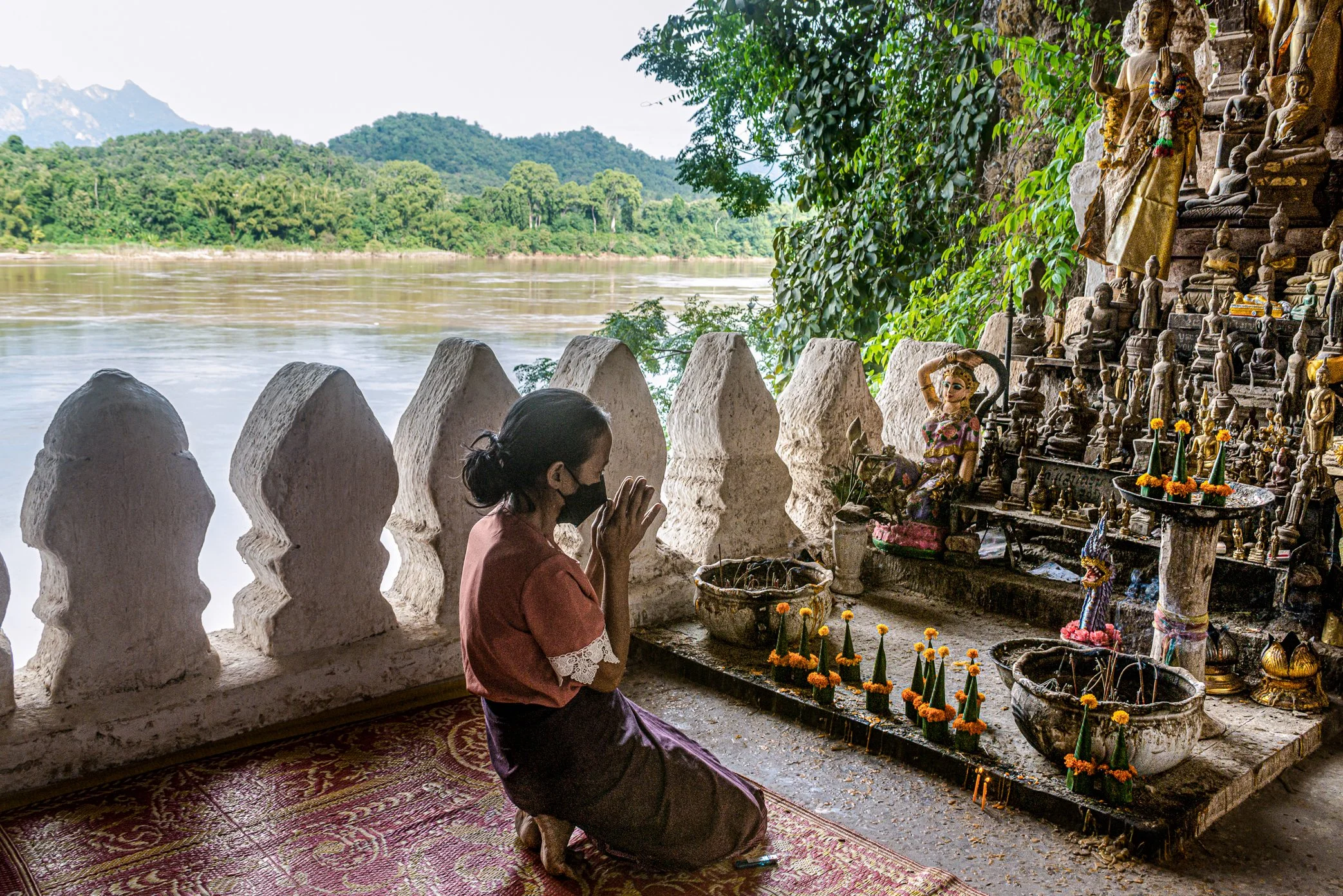
A souvenir seller prays inside Tham Ting, part of the Pak Ou Caves, a sacred cliffside site overlooking the Mekong opposite the mouth of the Nam Ou. Reached only by boat, the caves have drawn pilgrims, villagers, and tourists to Luang Prabang for generations. For local families, tourism here is more than a visitor economy. Selling food, boat services, and small souvenirs has long supported communities along this stretch of river. But merchants worry that nearby dam development and changing currents could make boat travel harder, reducing visitors and weakening one of the few reliable income sources tied directly to the river.
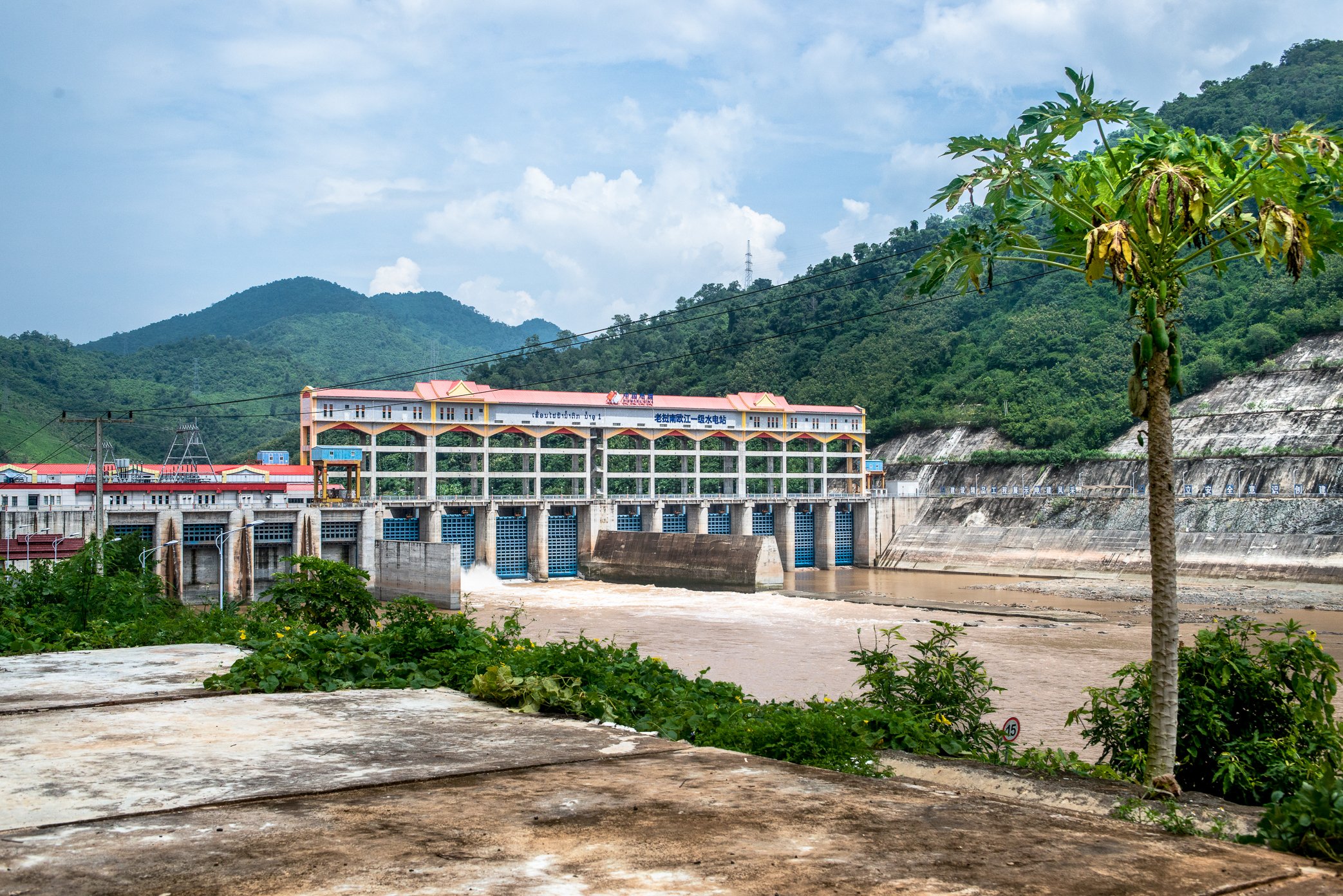
The Nam Ou 1 hydropower dam stands across the Nam Ou River in Pak Ou District, part of a wider hydropower cascade that has transformed one of the Mekong’s most important tributaries. The Nam Ou cascade includes seven dams, developed as a large basin-wide hydropower project. For the Lao government, dams represent electricity, revenue, and national development. For communities along the river, they have also brought relocation, reduced access to fisheries and natural resources, and a new dependence on cash income where food and materials were once gathered closer to home. The dam has changed more than the river’s flow. It has changed how people fish, farm, travel, worship, and measure security in their own villages. “After the dam, the river was no longer only a river. It became infrastructure.”
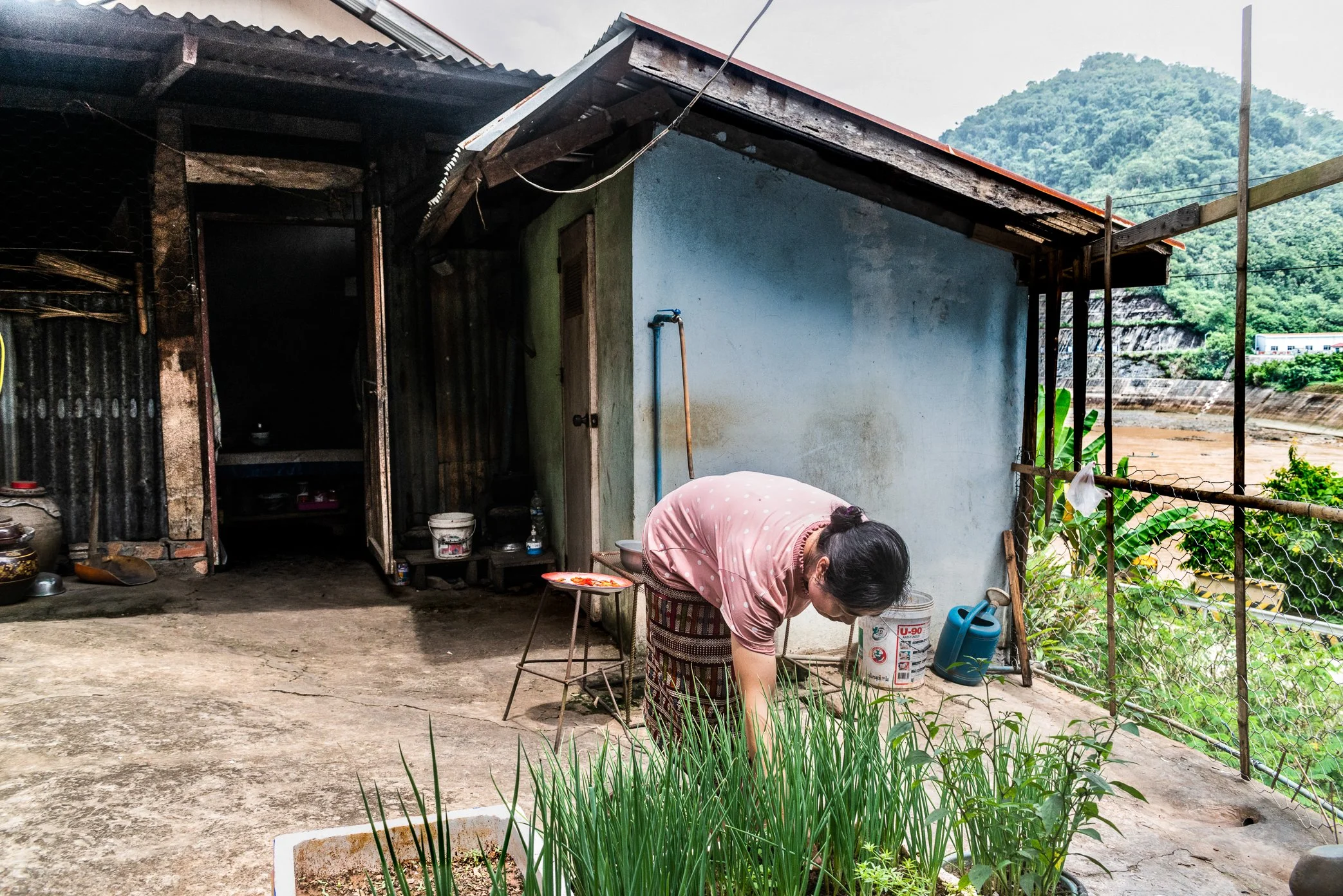
A woman tends a small vegetable bed beside her home along the Nam Ou River, where daily life has been reshaped by the construction and operation of hydropower dams. Before the dam altered this stretch of river, the space behind many houses was part of the family’s food system - a place connected to fishing grounds, riverbank gardens, and easy access to the water. Villagers could fish, grow vegetables, and gather part of what they needed close to home. Now, when the dam releases water, the river behind the village can become fast and turbulent, making it difficult and unsafe for small boats to go out fishing. Areas once used for planting have also been changed by concrete walls and altered riverbanks. “The dam did not only change the river.” It changed the small routines that sustained village life - when people could fish, where they could plant, and how much of their food they could still provide for themselves.
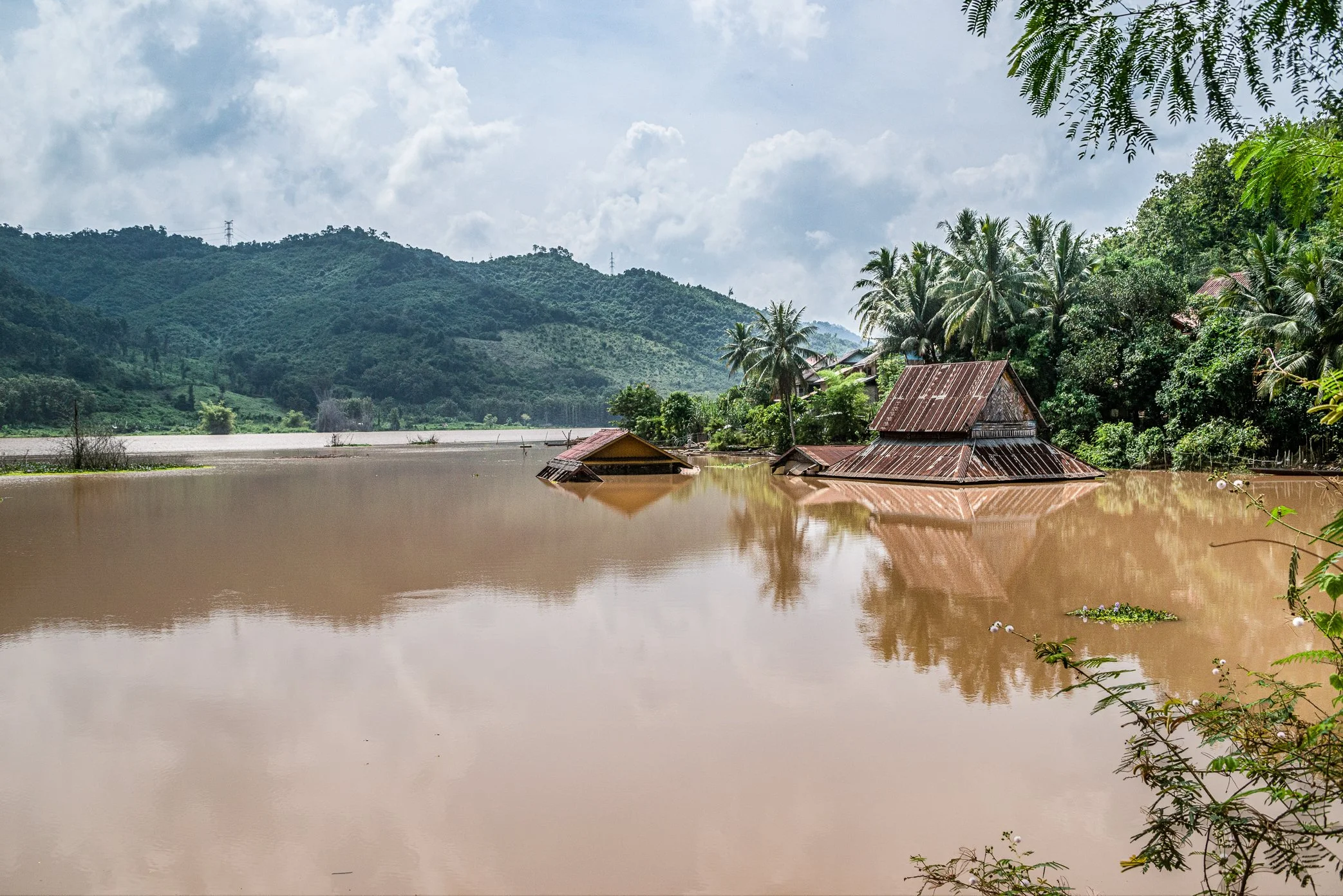
The old Sai Lom Yen temple stands partly submerged in the reservoir created by the Nam Ou dam, before the community was fully relocated. Once built on dry ground beside the river, the temple became one of the village landmarks swallowed by rising water after the dam changed the landscape. What had been a place of worship, ceremony, and daily community life was slowly transformed into a structure surrounded by floodwater. “When the river rose, it did not only cover houses and farmland.” It also covered places of memory, faith, and belonging. The relocation of the temple was presented as compensation, but the loss of the original site marked something deeper for villagers along the Nam Ou: the disappearance of a spiritual landscape that had connected people, river, and village for generations.
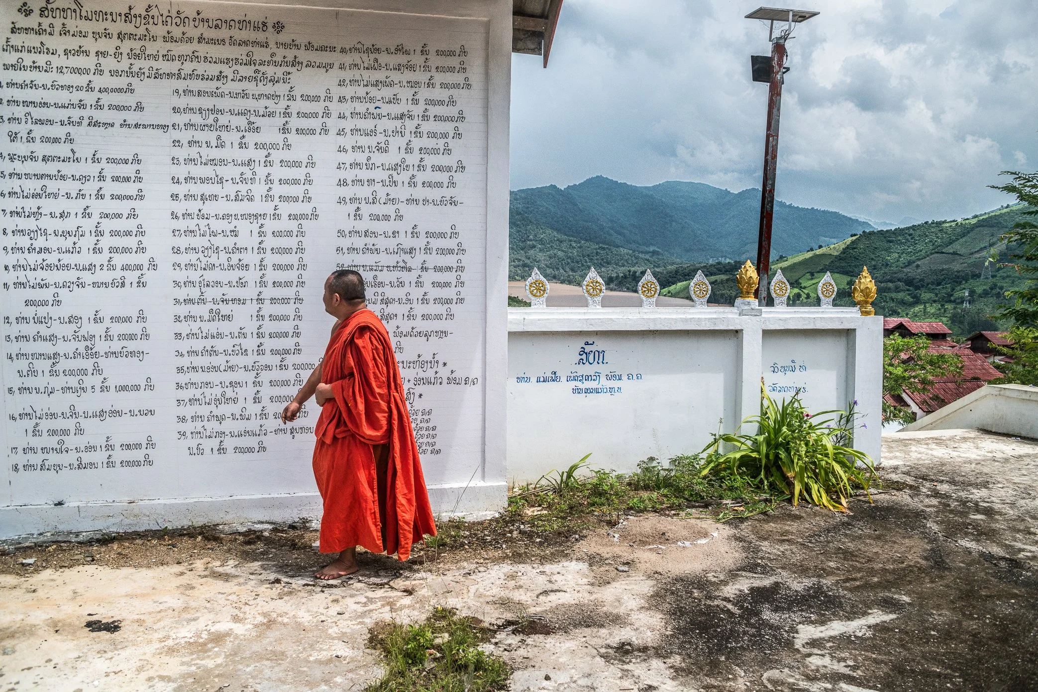
A monk stands beside the wall of a relocated village temple above the Nam Ou River, where the names of local donors are written in Lao script. The original temple, like many homes along the river, was affected by the construction of the first Nam Ou dam and later submerged within the reservoir area. As compensation, the dam project built a new temple for the community. But the replacement site was placed high on a mountain slope, making daily access difficult for both monks and villagers. “Relocation did not only move buildings.” It changed the rhythm of religious life - from the monks’ morning alms rounds to the villagers’ ability to reach their temple. With limited resources, local families donated what they could to help build a staircase from the village to the temple, replacing the steep dirt path that once made the climb difficult. Their names remain on the wall as a record of faith, contribution, and adaptation after the river was changed by the dam.
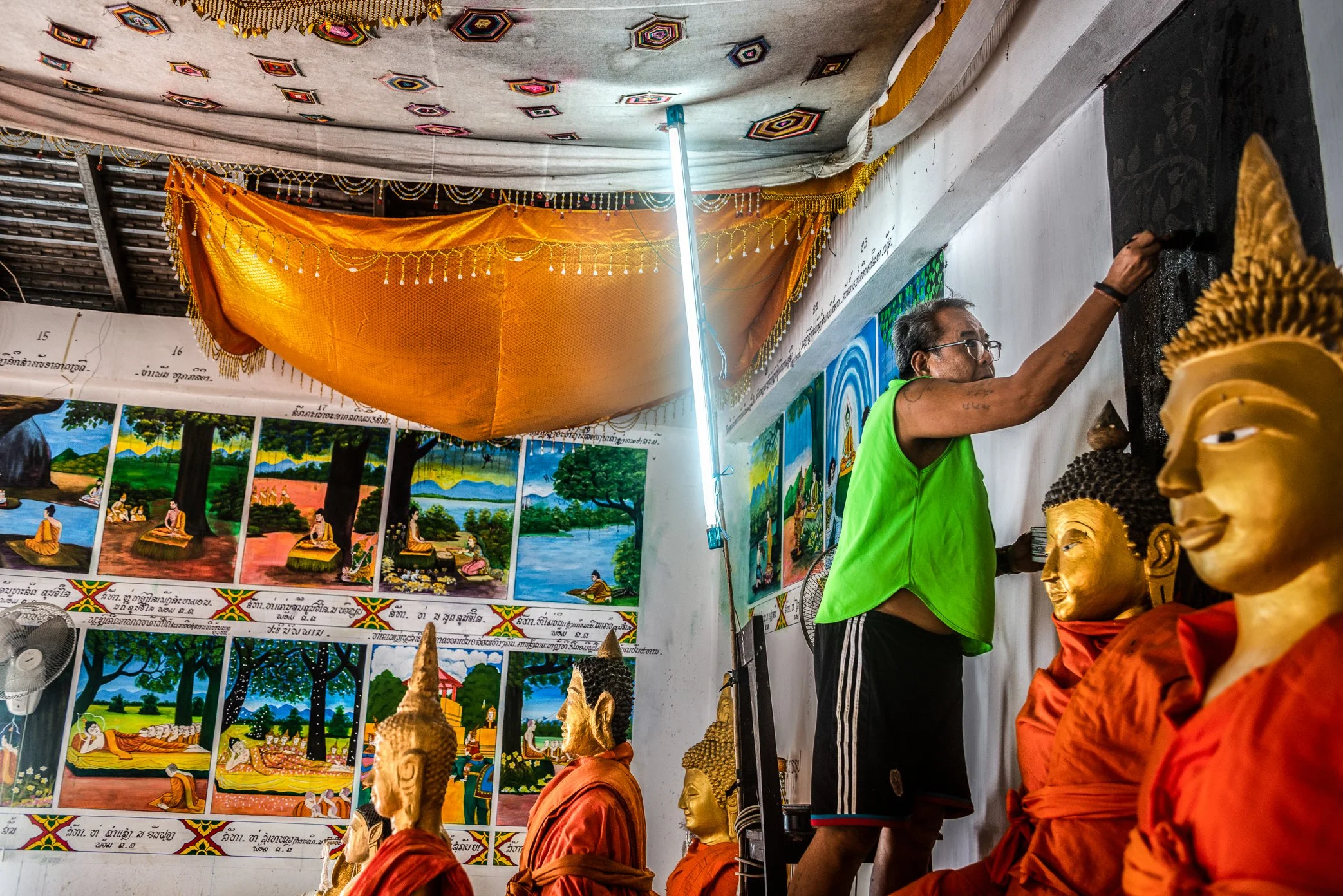
A painter restores murals inside a newly built temple relocated after the Nam Ou dam project changed the original village landscape. As part of the compensation process, the dam project provided a new temple building, land, and basic utilities. But for villagers, a temple is not complete with walls and a roof alone. Its meaning also comes from the paintings, stories, rituals, and local artistic details that make it a spiritual and cultural center of the community. “Compensation rebuilt the structure, but the villagers had to rebuild the soul of the temple themselves.” To bring the new temple closer to what had been lost, local families donated money to hire an artist to repaint the walls of the ordination hall with Buddhist stories and village memory. The work became more than decoration. It was an effort to restore continuity - between the old temple now lost to the dam, and a new place where faith and community life could begin again.
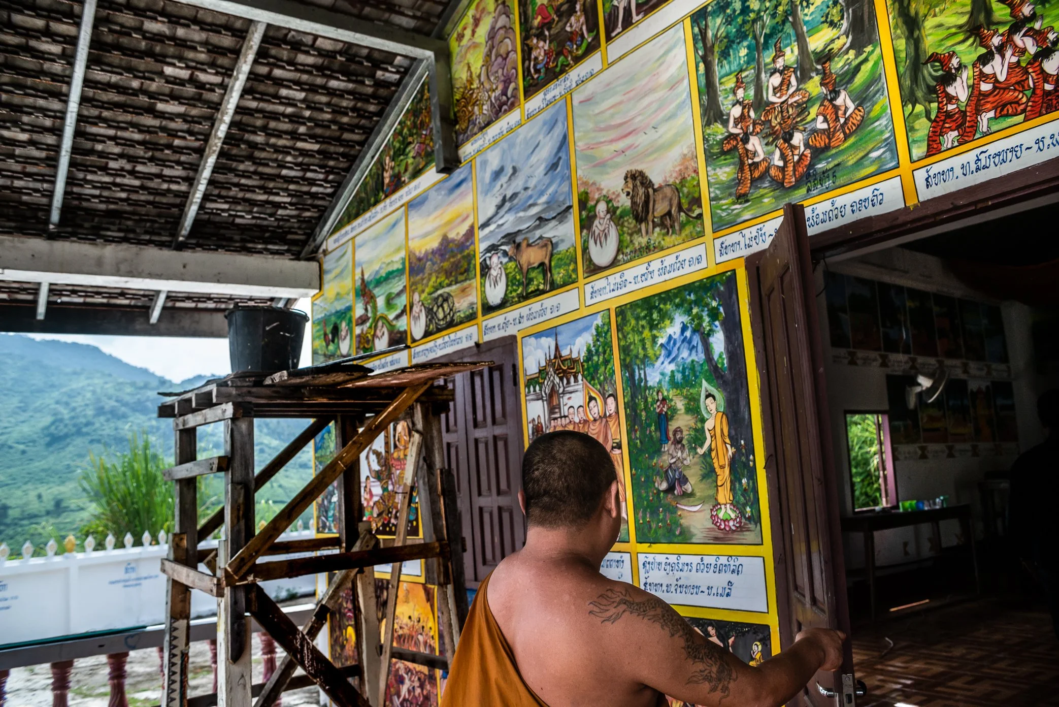
A monk opens the door to the newly painted ordination hall of a relocated village temple along the Nam Ou River. After the dam project provided only the basic temple structure, villagers raised their own money to restore what made the temple feel complete - the murals, Buddhist stories, and visual teachings that had shaped religious life in the old community. Each family contributed 250,000 kip to help repaint the walls of the church pavilion. The finished paintings now serve as both decoration and instruction, reminding younger generations of Buddhist history, moral lessons, and the village’s shared faith. Beneath each mural, the names of donating families are written as a record of contribution. “The dam project rebuilt the temple building, but the villagers rebuilt its memory.”

A villager sits inside the house he received as compensation after his former home was submerged by the Nam Ou 1 hydropower project in Pak Ou District, Luang Prabang. Official reports noted that affected families from the project were resettled as construction moved forward. But for some families, compensation did not fully replace what was lost. The new house was a basic concrete structure - an empty box with white walls - without the surrounding gardens, trees, farmland, and open family space that had shaped daily life in the old village. To make the house livable, he left home to work as a security guard in northern Laos, using his monthly wages to build the living area where he now spends most of his time with his family. “Compensation replaced the structure of a house, but not the life that once surrounded it.”
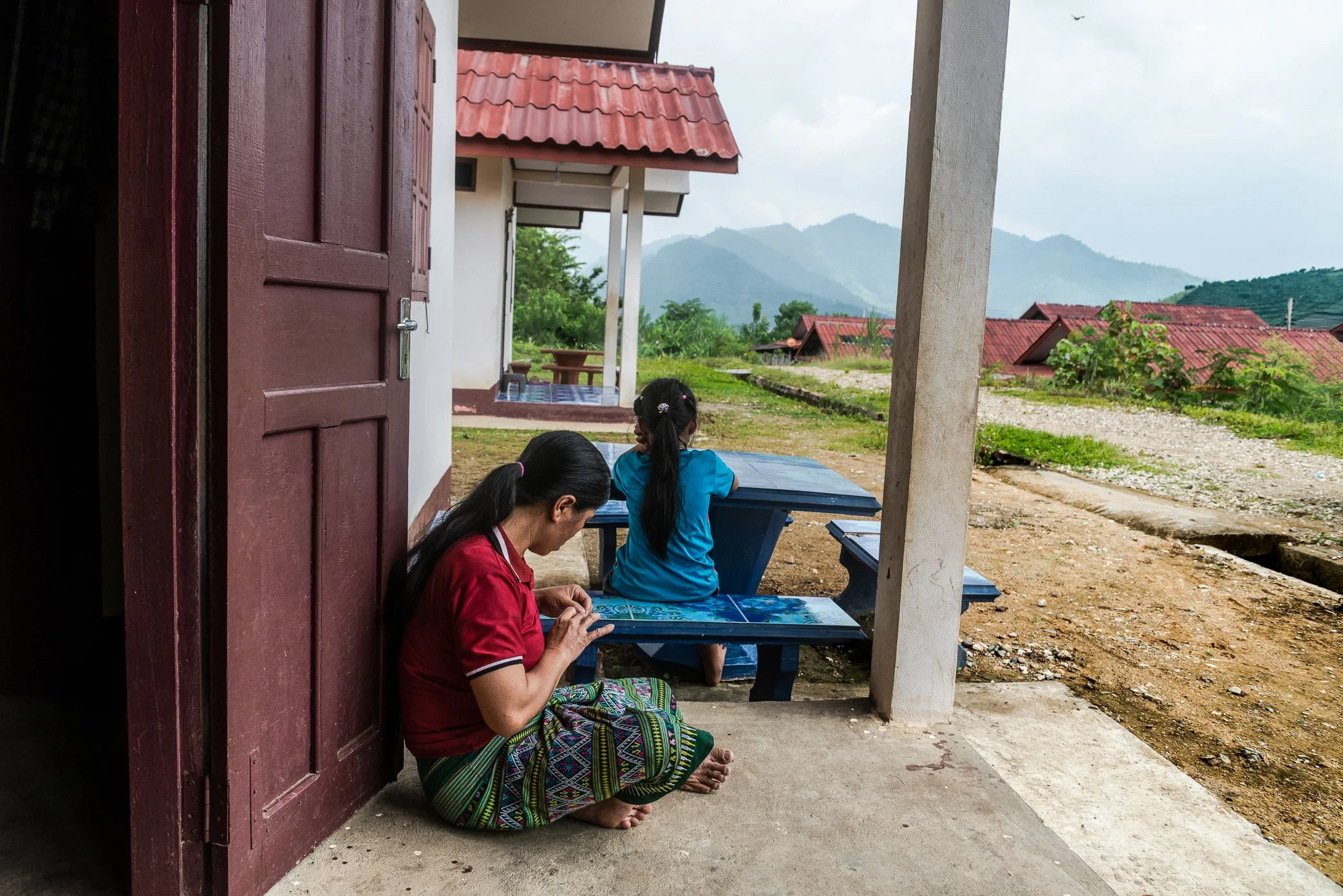
A woman and a child sit outside a resettlement house near the Luang Prabang hydropower project, in an area where families were moved from villages affected by dam construction. For many rural communities in Laos, a house is not only a place to live. It is also connected to small gardens, fruit trees, livestock, and nearby farmland that help sustain daily life. When families were relocated, compensation was offered for what they had lost. But for some villagers, the new land they received was on hillsides, with poorer soil and limited access to water. “Resettlement did not simply move people from one house to another.” It changed the foundation of daily survival. Without productive land around their homes, families who once grew part of their own food became more dependent on markets - and on cash incomes that remain limited. In the shadow of the dam, the cost of development is measured not only in land, houses, or money, but in the quiet loss of self-sufficiency.
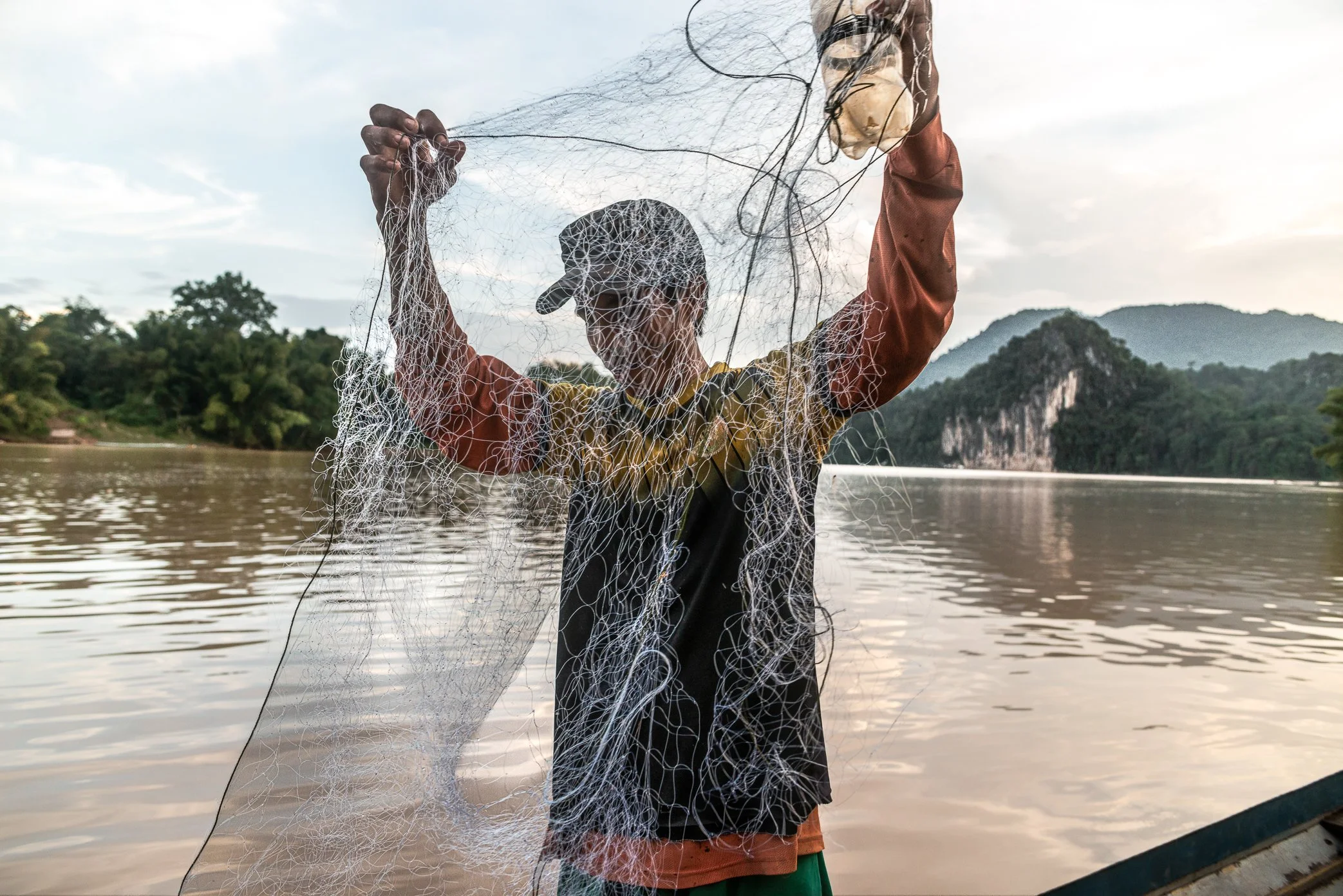
A fisherman from Pak Nam Ou village untangles his net near the confluence of the Nam Ou and Mekong rivers, where local families have depended on fishing for generations. For villagers here, the river has long provided both food and income. But in recent years, catches have become less reliable, and fishing alone is no longer enough to support many households. The pressure has grown heavier as the value of the Lao kip has fallen and daily costs have risen sharply. “A day without fish is no longer only a bad day on the river.” It can mean no food to bring home, no money to buy fuel, and another debt added to the family’s burden. With petrol prices rising and fishing grounds changing around the expanding Luang Prabang hydropower project, the river that once sustained village life is becoming harder to depend on. For fishermen at Pak Nam Ou, survival now depends not only on the river, but on how much longer they can afford to keep returning to it.

A fisherman from Pak Nam Ou holds his evening catch near the confluence of the Nam Ou and the Mekong. For generations, families here have lived with the river’s natural rise and fall, reading currents, seasons, and fish movements as part of daily survival. Now, many worry that dams built upstream on the Nam Ou and near the Mekong are changing that rhythm. Sudden shifts in water level and current can alter where fish move, when boats can travel, and how safely people can work the river. For fishermen whose livelihoods depend on timing and local knowledge, the water has become harder to predict.
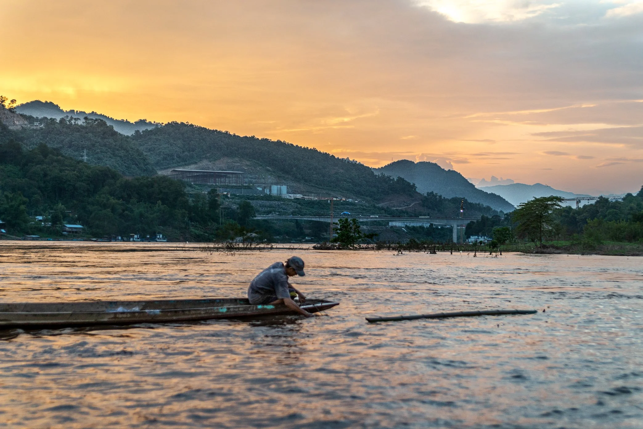
A fisherman from Pak Nam Ou works the evening water in front of his village as construction rises across the Mekong behind him. The bridge, built at speed through the mountain landscape, has become a sign of a larger transformation along the river. For villagers who depend on fishing, boat travel, and the natural rhythm of the Mekong, the new structure brings more than a road connection. Many fear it may be the first step toward further development - including a future dam nearby - that could alter currents, fish movement, and the fragile livelihoods tied to this stretch of water.